Geometry
Select your building’s footprint on the map and describe its floors.
For: AnalyzerWhere: Home › Geometry card
Steps
- On Home, click the baseline’s Geometry card to open Building Geometry.
- Select your building on the map with the Select a footprint to extrude tool. If the estimated area is incorrect, update Total Area manually.
- Complete the building details:
- Building Use Type
- Floor-to-Floor Height and Floor-to-Ceiling Height
- Above Ground and Below Ground - The number of floors
- Total Area
- Open Parking Area, Fully Enclosed Parking Area and Partially Enclosed Parking Area - Required only for the ENERGY STAR score
- Click Save changes.
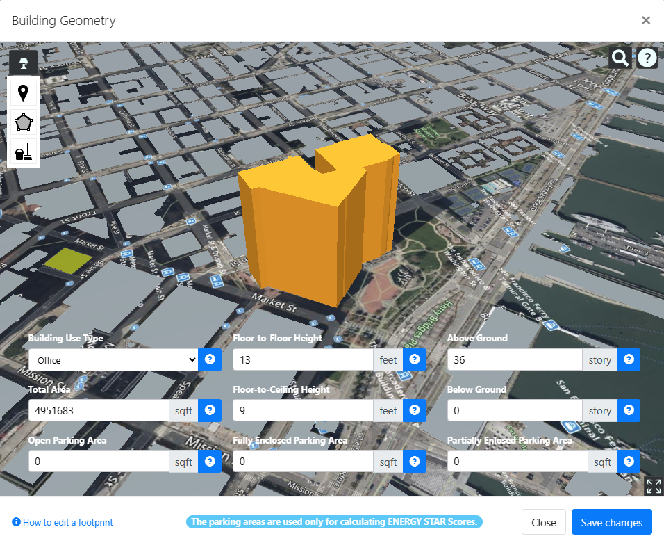
On a calibrated baseline, saving a different footprint, building use type, area, number of floors or floor heights sends the baseline back to preparation. Check inputs and run the calibration again afterwards. Moving the map view doesn’t.
The pre-processed footprints are only available for US buildings. For buildings in Canada, each footprint must be edited manually.
If your building is a recent construction and cannot be found in our GIS database, you can select a nearby building’s footprint for use.
What you’ll see next
The Geometry card no longer shows Pending. When all four cards are done, check inputs and run the calibration.
Edit a footprint
Adding markers increases the number of segments and the computation time, so simplify the footprint by removing any unnecessary markers.
- Click the Click to edit/create tool on the map and choose the footprint you want to edit.
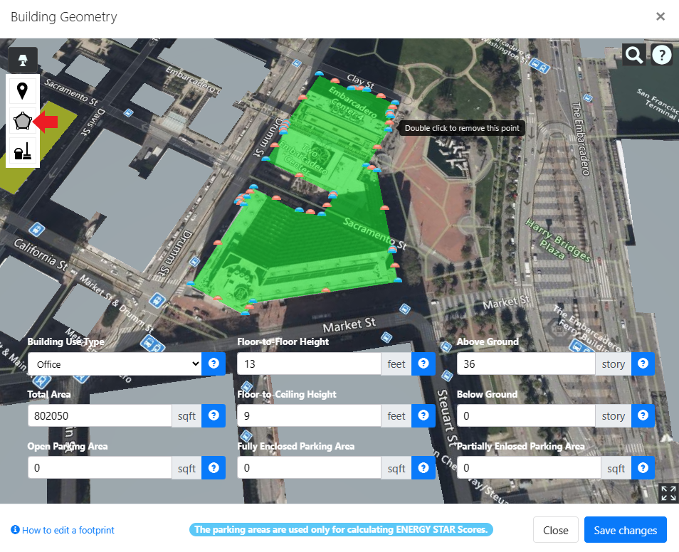
- The footprint outline enters edit mode, so you can add, move or delete markers. To delete a blue marker, double-click it.
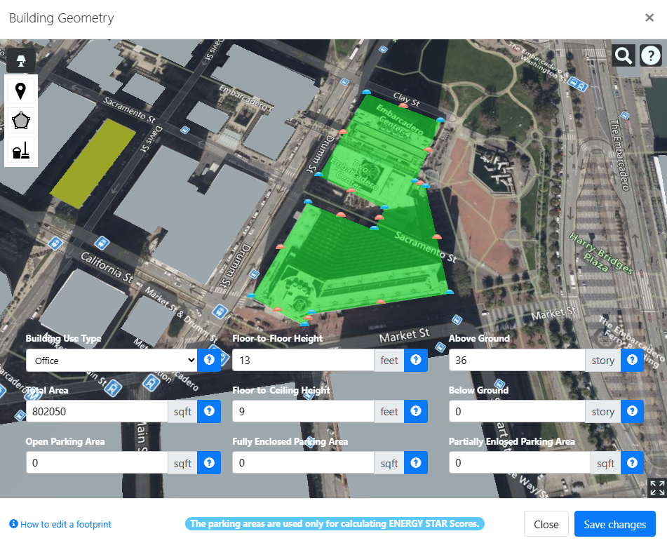
- When you’re done editing, click the Select a footprint to extrude tool and select the edited footprint.
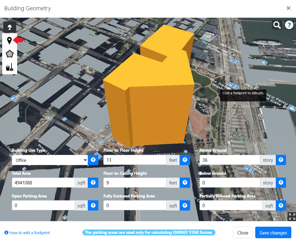
To start over, click Restore with an original footprint.
Split the building into two zones
If part of the building has a different use or HVAC system, split it into a main zone and a sub zone.
- Click the Draw a split line to divide the mass into two zones tool.
- Click on the map to draw a line across the footprint, then right-click to finish.
- Click Set as Main on the zone with the main occupancy. It is labeled Main Occupancy.
- Enter the number of Stories for the sub zone.
The ECM Explorer then shows separate measures for the main zone and the sub zone.
If something goes wrong
My building isn't on the map
Recent buildings may be missing from the map data. Select a nearby building’s footprint and edit it to match yours, then enter the correct Total Area.
My building is in Canada
Pre-processed footprints are only available for US buildings. Draw the footprint yourself with the Click to edit/create tool. See Edit a footprint.